 WINTER WONDERLAND RETURNS TO SHAWNEE PARK
A dazzling display of lights will be open and free to the public from December 19 – 21, 2025. Sponsorships and volunteer opportunities are still available!

Building an inclusive and vibrant West End for all of Louisville to live, shop, work, dine, and play.

OneWest is a community-focused nonprofit organization that supports, connects, and uplifts neighborhood residents by involving them directly in the West End’s commercial renaissance. We do this by securing funding, facilitating community connections, and providing workforce training.

...connecting meaningfully with others is the bedrock of all things. One light feeds another. One strong family lends strength to more. One engaged community can ignite those around it.
─ MICHELLE OBAMA
OUR PILLARS
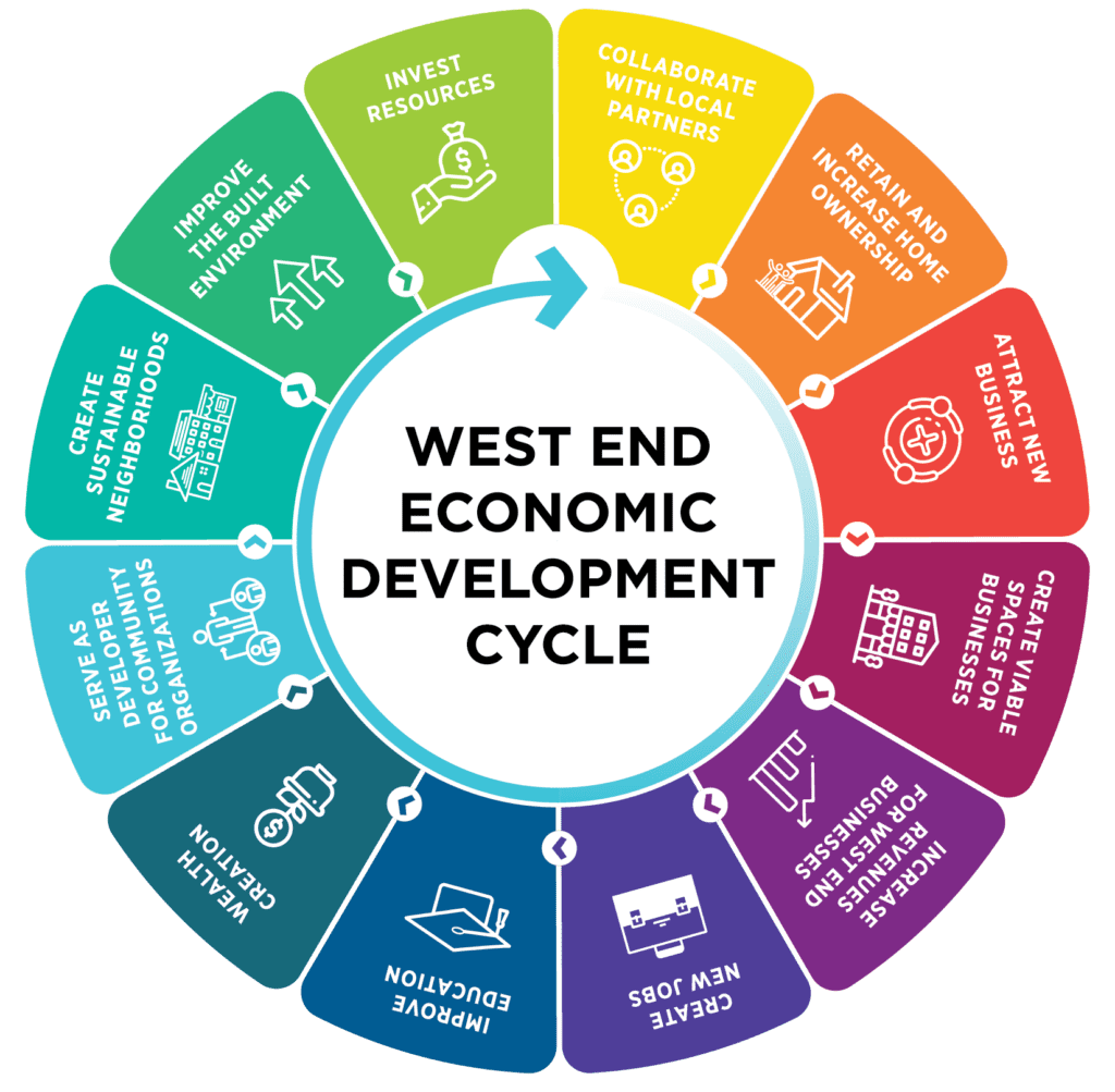
Commercial Development
Supporting and advancing commercial projects in West Louisville.
Community Advocacy
Championing resident needs and interests in development decisions.
Community Engagement
Actively involving neighborhood residents in shaping revitalization efforts.
Capacity Building
Providing resources, training, and support to bolster local individuals and businesses.
![]() BUILDING AN ECOSYSTEM FOR THE WEST END
BUILDING AN ECOSYSTEM FOR THE WEST END
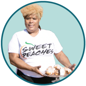
I'm grateful OneWest landed in our neighborhood. They listened to me, and I listened to them. They wanted to do good for this neighborhood, and so did I. There is no stopping us when we all work together.
─ PAM HAINES, OWNER OF SWEET PEACHES
![]() BUILDING WEST LOUISVILLE TOGETHER
BUILDING WEST LOUISVILLE TOGETHER

Read up on the latest West Louisville news!
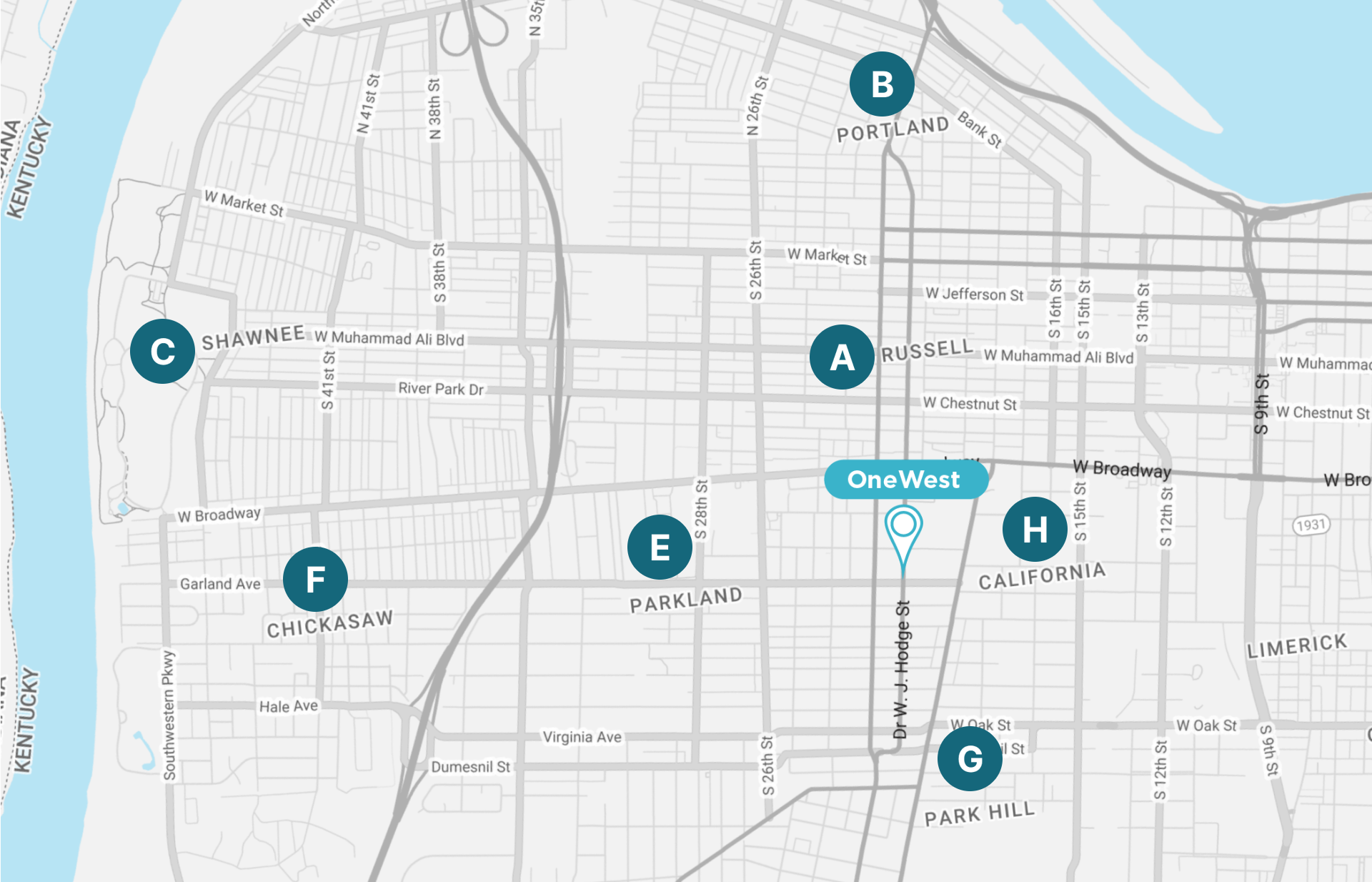
A. RUSSELL
Russell is a neighborhood immediately west of downtown. It was named for renowned African American educator and Bloomfield, Kentucky native Harvey Clarence Russell Sr. Its boundaries are West Market Street, 9th Street, West Broadway, and I-264.
By the 1940s Russell had become “Louisville’s Harlem” as African American theaters, restaurants, and night clubs lined area streets. However, in the years following World War II many of the middle class blacks left for newly integrated neighborhoods on the south and east ends. Urban renewal efforts in the 1960s had the area’s business districts razed and many public housing units built. America’s first public library open to African Americans is in Russell. The Western Branch of the Louisville Free Public Library, on 10th Street off Chestnut, opened in 1908.
The population of Russel is 7,622.
(N.d.). Population data retrieved from https://www.city-data.com/
B. PORTLAND
Portland is a neighborhood and former independent town northwest of downtown. It is situated along a bend of the Ohio River just below the Falls of the Ohio. In its early days it was the largest of the six major settlements at the falls. Its modern boundaries are the Ohio River along the northwest, north, and northeast, 10th Street at the far east, Market Street on the south, and the Shawnee Golf Course at the far west.
Portland, is experiencing a rebirth and a revitalization. Many young families are moving back and are attracted by the historic architecture and inexpensive starter homes in the area. Louisville artists are attracted to the new Art Gallery Warehouse District bordering 15th Street — home to Tim Faulkner Gallery, Louisville Visual Art, and the forthcoming Portland location of the University of Louisville Hite Art Institute.
The population of Portland is 11,917.
C. Shawnee
Shawnee’s boundaries are the Ohio River on the West, Bank Street and the Portland neighborhood on the North, I-264 on the East, and West Broadway on the South. Maps sometimes identify the area as Shawneeland.
Shawnee Park was completed in 1892 and residential districts sprung up around it quickly. In 1895, Louisville annexed Shawnee and extended streetcar lines. The land between Shawnee and Louisville was subdivided and many whites moved in during the early 20th century. The wealthiest areas were near the park and golf course, with middle- and working-class neighborhoods further east. The Flood of 1937 and air pollution problems caused many white families to move further east.
The population of Shawnee is 17,374.
D. Park DuValle
Park DuValle is a neighborhood southwest of downtown. Its boundaries are I-264 (the Shawnee Expressway) to the west, the Norfolk Southern Railway tracks to the north, Cypress Street to the east, and Bells Lane and Algonquin Parkway to the south. The neighborhood has several nearby parks, and DuValle Junior High School, named after Lucie DuValle, the first female principal of a high school in Louisville.
Residential development occurred in the late 19th century but most subdivisions were built after the 1940s. DuValle was originally part of Parkland‘s “Little Africa” community, where thousands of blacks had moved following the Civil War. The shanty homes of Little Africa were replaced with Cotter and Lang housing projects by Urban renewal efforts. Those now-dilapidated projects are being rebuilt with a HOPE VI revitalization effort.
The population of Park DuValle is 5,227.
E. Parkland
Parkland’s boundaries are 34th Street on the west, West Broadway on the north, Woodland Avenue on the south, and 26th Street on the east.
It was originally called Homestead and was incorporated in 1874. In 1884 the name was changed to Parkland. The neighborhood was initially a wealthy suburb of Louisville. However, a tornado on March 27, 1890 devastated Parkland, and Parkland was annexed by Louisville in 1894. When rebuilt, part of Parkland was called Little Africa, but many mansions were built in “White Parkland.” Little Africa was demolished in 1948 to make way for several housing projects.
Muhammad Ali’s home is located here, and has been restored to its original 1950s condition. In 2016, the home opened as a museum called the Muhammad Ali Childhood Home Museum.
The population of Parkland is 4,561.
F. Chickasaw
Chickasaw’s boundaries are West Broadway, 34th Street, Hale Avenue and Chickasaw Park.
Chickasaw Park is predominantly black and middle-class. Before integration, Shawnee Park was reserved for whites, while Chickasaw Park was reserved for blacks. Integration has led to a decrease in use for Chickasaw as more people prefer the larger Shawnee to the north.[1]
In 1969, Elmer Lucille Allen, a scientist and artist from the neighborhood created the Chickasaw Little League. The little league was in operation for four years and was created to accommodate the children who lived in the Chickasaw neighborhood who were not permitted to participate in the little league held in Shawnee Park.[2]
The population of Chickasaw is 5,046.
G. Park Hill
Park Hill is located just west of Old Louisville. Its boundaries are the CSX railroad tracks to the east, Hill Street to the south, Twenty-sixth Street to the west, and Virginia Avenue and Oak Street to the north.
In the 19th century, the southwestern farmland portion of the neighborhood was known as the Cabbage Patch, the citizens of which inspired Alice Hegan Rice’s 1901 children’s novel Mrs. Wiggs of the Cabbage Patch.[1]
The population of Park Hill population is 7,477.
H. California
California’s boundaries are West Broadway, Ninth Street, Oak Street, and Twenty-Sixth Street. It is said that the subdivision, initially called Henderson, came to be known as California because it was the “far west” of Louisville.
After the Civil War, African Americans settled in the area, starting the California Colored School and a branch of the Freedmen’s Bureau. The neighborhood lost 50% of its population and 40% of its single-family housing from 1950 to 1980 and became known for its urban decay.
The population of California is 5,958.
I. Algonquin
Algonquin is known for its beautiful architecture, including shotgun houses and Victorian-style homes.
The neighborhood is also home to several parks, including the popular Algonquin Park, which offers playgrounds, sports fields, and a community center. Algonquin is a lively neighborhood with a rich history and is known for its tight-knit community and annual events, including the Algonquin Festival.
The population of Algonquin is 6,001.
![]() STAY INFORMED
STAY INFORMED
Stay up to date on all of our upcoming projects, volunteer opportunities, news & more!
